
CLASSES
Take a class at Fox Valley Tech for fun, personal enrichment or career development. Find classes in any location during any time of the day. We have hundreds of classes to fit your budget, schedule and learning style.
CATEGORIES
Sorry, no results were found. Please check back later.
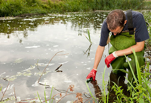
Examines the physical, chemical and biological characteristics of surface and groundwater. Water quality standards and regulations are discussed. Surveys of the various forms and sources of water pollutants are conducted, and water quality assessments, using biological indicators and chemical tests, are covered. The course includes a brief overview of the treatment process.
Introduces the student to the requirements for the 1.5 mile run, 3 mile pack test and step test which are required by wildland fire hiring agencies.

Examines the role of wildland fire and firefighting throughout history to the present.

Provides a basic study of the trees, grasses, herbs and aquatics of Wisconsin. The class focuses on the principal species of seven major plant communities: forest, bog, agriculture, prairie, marsh, shrub and beach.

Combines two NWCG classes. S-131 is Firefighter Type 1 training. Sometimes called Squad Boss, these are the entry-level supervisors in wildland firefighting. Topics include operational leadership, communications, LCES, and tactical decision making. S-211 consists of three skill areas including supply, delivery and application of water.
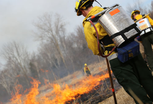
Planning, execution, safety, coordination and evaluation of an ignition operation on a wildland or prescribed fire.

Introduces the use of an auto level, laser level and theodolite. Emphasis is on the fundamental concepts and principles of basic topographic surveying and mapping. Several computer programs are used to generate maps.

Operation of heavy equipment of hand tools used in wildland fire.

Prepares new firefighters in basic firefighting skills and behavior factors that will aid them in the safe and effective control of wildland fires.

Introduces wildlife ecology and management. The course focuses on habitat restoration and maintenance, deer management, wildlife damage control, ecological concepts and population dynamics.
